May 2023
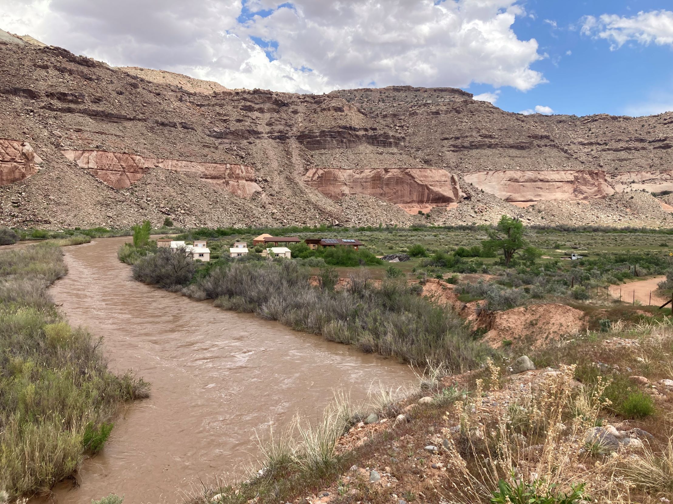
 Dolores River at 6,870 cfs. May 2023.
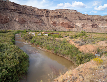
 Dolores River at 30 cfs. September 2022.
Further Reading
Dolores Water Conservancy District
Dolores River Restoration Partnership
Flow Management and Endangered Fish in the Dolores River, 2012-2017
Tamarisk biocontrol in the western United States: ecological and societal implications
Bonderman Field Station has been experiencing historic flows on the Dolores River this spring–more than 250% above average. Snowmelt from a record-high snowpack in the San Juan Mountains has filled the upstream reservoir at McPhee Dam to near capacity. In order to create more room for inflows from the Upper Dolores River, dam operators ramped up releases to 4,000 cfs (cubic feet per second) in May, meeting a record set in 2017.
What does that mean for those of us living downstream on the Lower Dolores River? Historic flooding. Silty water pouring over banks and inundating low-lying fields, where stands of willow, tamarisk, and cottonwood trees guzzle their fill. An orange globemallow that once germinated on land, now finds itself blooming in an eddy. Nearby, water surrounds and saturates an ant’s nest, its residents scurrying about on what solid earth there is left, before their home is swept up into the river’s organic detritus. Us human residents are scurrying about, too, pulling equipment, raising cabins, and plotting high water marks.
The work of flood mitigation tries our patience at times. We troubleshoot and scheme, shovel earth into sandbags and onto berms, only to find our work is underwater in the morning, mired in the muck that sucks on our sandals. But amidst losses, there are also wins. The cabins we raised on cinder blocks seem to be faring well, even as the river’s edge has crept up to within a few feet of their bases. Meanwhile, our irrigation pumps now sit on wooden platforms above the waterline, ready to feed floodwater to our ditches and gardens.
Historical perspective offers another kind of salve to our frustrations. While we toil to protect infrastructure necessary for educational activities, the Native peoples and European homesteaders who came before us likely faced the destruction of everything they had when the river flooded higher than anticipated. Today, we have the benefit of emergency warning systems, flow rate projections, and weather forecasts to help us prepare for historic highs. There’s also the dam, which regulates flows. Built in 1984, McPhee Reservoir banks a dependable source of Dolores River water for farmers, municipal users, fisheries, and energy production in southwestern Colorado. (Notably, the Dolores Project also delivers water to the Ute Mountain Ute Reservation under the 1988 Colorado Ute Indian Water Rights Settlement Act, settling decades-long negotiations over their water rights claims.) The dam moderates seasonal spikes, controlling releases to provide more consistent and predictable flow patterns for various agricultural, economic, and recreational activities. Prior to the Dolores Project, peak spring flows on the Dolores River could reach up to 17,400 cfs. When dam operators increased releases to 4,000 cfs this May, the field station experienced peak flows of just over 8,000 cfs, giving us only a glimpse of what seasonal flooding might have looked like before the dam’s construction.
Despite the benefits of dams, there are high ecological costs to a predictable river. McPhee Dam disrupts the Dolores’s natural rhythms, preventing important ecological processes from taking place. Floods transport sediment-bearing water downstream that recharges channels, floodplains, and groundwater stores, builds vital beach habitat, and carves out nutrient-rich niches for native fish, microbial life, insects, birds, reptiles, and mammals. In a desert environment with limited perennial surface water, where life cycles are adapted to variable flows, seasonal flooding is necessary for survival.
Dams fundamentally alter flows, changing a river's character and limiting the diversity of life that it can support. Low water availability downstream of McPhee Dam over the past few decades has promoted the proliferation of invasive tamarisks, whose root depth is nearly twice that of native cottonwood trees, making it easy for them to displace natives. While diminishing forage and habitat, tamarisks increase soil salinity and contribute to channelization, preventing nutrient exchange between the river’s corridor and surrounding floodplains. Likewise, McPhee Reservoir is home to invasive walleye and smallmouth bass that escape the dam’s spillway and prey on native flannelmouth sucker, bluehead sucker, and roundtail chub, devastating sensitive populations already beleaguered by low flows, channelization, and high water temperatures. While periodic dam releases and invasive removal projects have had some marginal success in recent years, large-scale restoration of the Dolores’s riparian habitat continues to evade government agencies, researchers, and conservation groups.
In a climate trending toward a hotter and drier future, the river’s human-engineered pulse has grown fainter over time. Last summer, when the Dolores was running at a trickle and we were digging in the riverbed to submerge our irrigation hoses, the river’s current volume of water would have been difficult to imagine. This year, we–and the local wildlife–are relishing in a much-needed soak, however inconvenient high water levels may feel to our day-to-day activities. The researchers who run experiments, make observations, and collect data here at the field station often consider questions about the interdependence of species, the enduring bonds among all of us that determine our ability to subsist and survive. As anthropogenic climate change threatens the tenability of all life on Earth, it’s clear that human compromises must be made–and soon. The river flows high today, but tomorrow is a perpetual question mark. How might we reconsider water management in the west to support the land’s resilience as we shore up our own?
Taylor Cunningham, Staff
